Sunny and calm conditions for the next several days
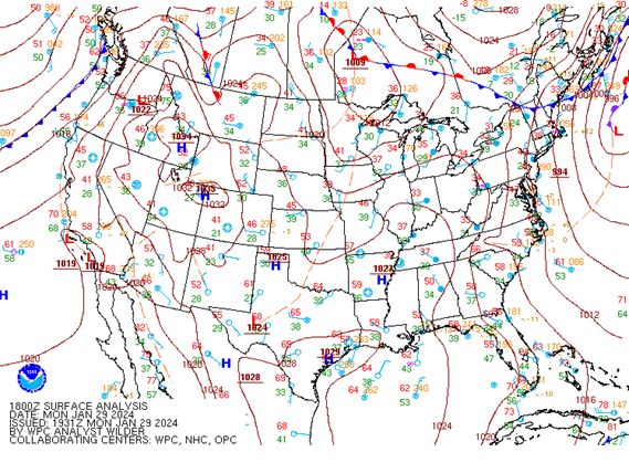
Monday afternoon saw mostly sunny skies as cloud cover from earlier in the day moved eastward. This will continue into the overnight hours as we see partly cloudy skies and calm winds for the evening. The calm conditions are caused by high pressure building into the area behind last Saturday’s low pressure system. High pressure is expected to control our forecast for the next several days, making this week a great time to plan any outdoor activities. Any remaining cloud cover from overnight will move out by Tuesday morning as we see clear blue skies throughout the day tomorrow. We will continue to see lots of sunshine as we finish out the month of January this Wednesday. The first two days of February will be similar, with mostly clear skies sticking around until Friday evening when, cloud cover starts to increase ahead of our next chance for rain this weekend. Another low pressure system is expected to arrive between Saturday and Sunday evening, bringing a chance for showers and thunderstorms.

Up and down temperatures
Along with calm conditions, Monday also had below average temperatures. The afternoon high peaked in the mid to upper 40s where it would typically be in the mid 50s. This is because of the aforementioned weekend low pressure system and subsequent cold front on Saturday night. This will change as high pressure is returning to the area. Overnight temperatures will be average with lows dipping into the lower 30s for the start of Tuesday morning, but this will change a lot by Tuesday afternoon. Temperatures are expected to peak in the mid 60s tomorrow which is 10 degrees above average. That also means that we will warm by more than 30 degrees from morning to afternoon, so dressing with removable layers is recommended. Tomorrow evening will continue to see temperatures slightly above average as they will only drop into the upper 30s.
A dry cold front will swing across the area Tuesday night, briefly bringing temperatures back to normal on Wednesday. Afternoon highs will be in the lower 50s with lows back in the low 30s, giving us a very reasonable last day of January. Things will quickly warm back up for the start of the new month with Thursday and Friday seeing highs in the upper 50s to mid 60s and lows around 40 degrees. Overall, the mild temperatures coupled with lots of sunshine makes for plenty of chances to enjoy getting outdoors during the week before more active weather conditions arrive on Saturday. Despite the rain, temperatures will remain above average during this time.
Annea Scales
Student Meteorologist
