Mississippi State University Weather

Seasonable Weekend Ahead

Seasonable Weekend Ahead

Apr 25, 2024

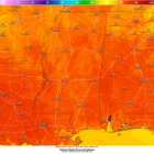
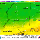
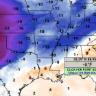
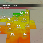
This morning, we started the day with partly sunny skies. Temperatures are expected to make it to 80 degrees today. This is all thanks to a high-pressure system that is to our south, moving east towards Georgia and the Carolinas. There is a small chance that we will see some showers and thunderstorms along and North of highway 82 this afternoon thanks to a stationary front that has stalled over parts of northern Mississippi. The chance for showers and storms will quickly end in the evening hours as the front moves north. Tonight, it will be partly cloudy with temperatures in the upper 50s to lower 60s for the region. WARMER TEMPERATURES FOR THE WEEKEND This weekend will be beautiful for any outdoor activities that you may have planned, as it will be mostly sunny with a few clouds possible. There may be a chance of a shower or two this weekend in some areas, but confidence is not high. Temperatures are expected to be above average in the lower to mid 80s. This is due to a warm front that moved through the area, which is bringing in warmer temperatures from the Gulf of Mexico and high-pressure system that is still in place. This will also cause strong winds coming out of the South which will lead to winds being around 5-15 MPH with wind gusts anywhere up to 25-30 MPH for the entire weekend. NEXT WEEK After the dry week that we have had, rain chances are coming back into the forecast for late Sunday night into Monday morning. Warm, moist air due to high pressure that is still in place over the region, will set us up for a disturbance that will move into the area ahead of a cold front. Rain amounts are expected to be heavy due to the amount of moisture that will be available in our atmosphere, and we can expect anywhere from 0.5 to 1 inch of rain from this event. Tuesday morning there is a chance that there will be a lingering shower or two, but not much rain is expected. Looking past Tuesday, high-pressure will move into place over the Mississippi Valley region, which...

Great Weather Ahead for Mississippi This Week!

Great Weather Ahead for Mississippi This Week!

Apr 22, 2024

Temperatures on Sunday at 1 pm As we go into the workweek, expect overall dry conditions and gradually warming temperatures from the upper 60s Monday, all the way into the mid-80s by Sunday! The best chances of rain to come this week are on Wednesday and Thursday.  Monday-Tuesday:  A high pressure system will move on through Mississippi throughout Monday and Tuesday bringing in cool and dry northerly winds into our region. Expect sunny conditions Monday, with highs to reach the mid-60s and lows to be in the low 40s, with both of these temperatures being roughly 10 degrees cooler than the average for mid-to-late April! For Tuesday, expect much of the same story in terms of being dry and nice outside, but there will be a nice bump up in temperatures thanks to the absence of the high pressure system moving on into the east coast. This will introduce warmer and more humid southerly winds into our region. Overall, it will still be comfortable, with sunny conditions. We will have highs in the mid-70s and lows in the mid-50s.  Expected temperatures on Tuesday at 3 pm Wednesday-Thursday:  Wednesday and Thursday will be the two days to consider for any potential showers or storms. On Wednesday, a weak surface front will pass along our region throughout the day that could cause a shower or two. Overall, we don’t see the frontal system being strong enough to create many, if any, storms, so expect mainly sunny conditions, with highs in the upper 70s and lows in the upper 50s. Thursday will probably have the best chance of rain this week, as a stronger short wave will enter our region, causing a greater chance of showers and isolated t-storms throughout the morning and mid-afternoon hours. Expect a 30% chance of isolated t-storms, with highs in the upper 70’s and mostly cloudy conditions at night, with lows in the mid-50s. Thursday rain outlook at 1 pm Friday-Sunday:  If you are looking for a nicer weekend compared to what we had last week, you got it! Ridging will build in our viewing area starting Friday and continue to strengthen into the weekend, which will bring in much warmer and...

Warm Temperatures, Storms Likely For Super Bulldog Weekend

Warm Temperatures, Storms Likely For Super Bulldog Weekend

Apr 18, 2024

If you haven’t been a fan of the above normal temperatures, you’re in luck. Some relief is on the way but, you will just have to wait a few more days. Temperatures will continue to be above normal until this weekend, as highs will dip into the upper 50s for Sunday. These will be below average for this time of the year. TODAY AND TONIGHT Spotty showers are still expected during the late afternoon hours. It won’t be a total washout as you’re heading home for your evening commute or sporting activities. Tonight, a cold front moves into the region giving way to some thunderstorms. Lows tonight will dip into the upper 50s. These storms do have the potential to be severe, as the Storm Prediction Center has a marginal risk put out for the area. Damaging winds and heavy rain are the main threats. SUPER BULLDOG WEEKEND The 3-game series between Mississippi State and Auburn baseball is expected to begin at 6pm on Friday. First pitch, you can expect mostly cloudy skies. So, a light sweater might be suitable as the winds may cause the temps to feel a degree or two colder. Low temperatures will reach the 60s with a north wind at 5 mph. Saturday into Sunday, rain percentages will range from 50-70%, so be sure to bring an umbrella or jacket as you’re heading out to any of the sporting events. After these rounds of showers and thunderstorms over the weekend, a high pressure will gradually begin to slide into the region Sunday. This is bringing dry conditions and cool temperatures into Monday with lows being in the 40s. Temperatures begin to warm back up to near and above average early next...

Clouds Return Monday and for the Rest of the Week after a “Picture Perfect” Weekend

Clouds Return Monday and for the Rest of the Week after a “Picture Perfect” Weekend

Apr 15, 2024

After a divine weather weekend, clouds will return on Monday and remain throughout the week. With temperatures remaining warm in the low- to mid-80s, a temperature drop is expected on Sunday. There is a slight chance of showers Tuesday night, which will linger through the rest of the workweek and into the weekend. By Thursday and Friday, we will see rain chances persist throughout the day. So, if you’re planning on attending either some Bulldog or Yellow Jacket baseball, it wouldn’t be a bad idea to come prepared with some rain gear, just in case. With that being said, the chance of showers will begin to increase throughout the weekend as a cold front passes through on Saturday. Today into Tomorrow Night We are having a beautiful Monday to begin the workweek, as temperatures sit around the low 80s. A light wind blowing at 6-8 mph from the south will continue throughout the day and into the night. Temperatures will cool off into the low 60s Monday night, and cloud cover will build up and remain throughout the night and into Tuesday, making Tuesday a rather cloudy day. Temperatures will peak in the low 80s again on Tuesday, but winds will blow southerly, and vary from 6-16 mph, with gusts reaching 25 mph, as showers move into our area. By late Tuesday night, a chance of rain is expected. Slight Rain Chances Persist Throughout the Week These southerly winds are also blowing moisture in from the Gulf of Mexico, effectively raising our dew point temperatures, thus making it a quite humid week. We will see a chance of rain is expected after 2 pm come Thursday. Come Friday, if you’ve made plans to go out and about in the morning, or you’re just walking to class, prepare for some showers. Temperatures will remain in the 80s throughout the week until Saturday night, where a cold front will then blow through, cooling us down, and allowing us to see temperatures drop to the upper 60s. This will give the Bulldogs a rather cooler day at the Dude to wrap up the series against Auburn. Keep in mind, a chance of rain persists through Sunday. To...

Soggy and Windy Thursday, But Sunny Weekend Ahead!

Soggy and Windy Thursday, But Sunny Weekend Ahead!

Apr 11, 2024

TODAY AND TONIGHT After a rather rainy and stormy beginning to our workweek, we finally are seeing the light at the end of the tunnel! Northeast Mississippi has seen lots of rain over the past 24 hours, with the bulk of the rain totals in the western portion of our viewing area. Grenada and northern parts of Winona received over 7.5 inches of rain! Starkville received just over 2.5 inches of rain, and this is on top of what we already received Monday and Tuesday! Although we are out of the flood watch, it is important to remember the saying, “turn around, don’t drown”, when approaching flooded roads. A cold front will pass through during the afternoon hours, which will push any leftover rain showers out to our southeast. As the front passes, wind gusts will start to pick up, gusting over 30 mph throughout our viewing area. During the later part of the afternoon, we could see some of the greatly missed sunshine peep through those clouds! This will be a great time to take those furry friends on a walk but be sure to grab a light jacket. Due to the passing front, temperatures will have a steady drop as we go into the nighttime hours, hitting the lower 60s by 6pm. Our overnight low will be in the mid to upper 40s, with clear skies and calming wind gusts. TOMORROW Due to a high-pressure system that will be coming from the west and stationing over parts of East Texas, Western Louisiana and along the gulf, we will start to see sunshine come into the forecast once again! High temperatures will hit 70°, with very limited cloud cover, if any at all. Overnight lows will once again drop into the mid 40s, due to clear skies and no cloud coverage being able to trap in the warmer air.  THE WEEKEND It will be all sunshine and rainbows for the weekend with temperatures increasing each day! High temperatures will near 80° on Saturday with partly cloudy skies. Sunday is when we will hit the lower 80s making it a nice day to sit out at the pool. EARLY NEXT WEEK Temperatures will continue to increase into...

Soggy Tuesday, with more rain and possible severe storms on the way

Soggy Tuesday, with more rain and possible severe storms on the way

Apr 9, 2024

TODAY & TONIGHT: We had a wet morning, and unfortunately the rest of our Tuesday is looking to be gloomy and dreary, with more rain on the way. We could potentially see a break in the rain during the evening hours, but the rain will pick back up late tonight and through the overnight hours. Some of this rain could be heavy at times and even could produce flooding in some communities. Because of this, the National Weather Service in Jackson placed northeastern Mississippi counties under a flood watch that will last through Wednesday at 7:00 p.m. Between now and Wednesday evening, total rain amounts are looking to be between 2 to 5 inches. Make sure to grab your umbrella! Severe storms are not expected for the rest of the afternoon and tonight but heavy rainfall is in the forecast. Temperatures will warm into the upper 60s and lower 70s due to the cloud coverage, and it could be a bit breezy at times, with winds out of the southeast at 10 to 15 mph and gusts up to 20 mph. By Tuesday night, temperatures will fall into the lower 60s, with rain lasting through the night. WEDNESDAY: Wednesday will be the most active day of the week, with persistent rainfall that could lead to flash flooding, as well as storms that could potentially be severe. The Storm Prediction Center has outlined most of our viewing area in an enhanced risk, a level 3 out of 5 for severe weather. Stronger severe storms could be possible towards the I-20 corridor and south in central and southern Mississippi, as they have been placed in the moderate risk, a level 4 out of 5. For us here in northeast Mississippi, all modes of severe weather are possible including damaging winds up to 70 mph, hail up to golf ball size, and tornadoes. Timing for the event looks to be through the afternoon and into the evening hours as the surface low tracks east. Make sure to have a reliable way to receive warnings! Temperatures will remain in the low 70s during the day and cool down into the upper 50s at night. REST OF WEEK AND...