Feb 8, 2024
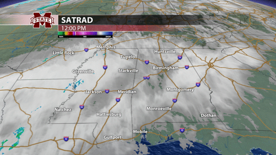
Hope everyone is having a great week! The weather sure has been wonderful these past few days with sunshine and warm temperatures well into the 60s. As of Thursday afternoon, satellite and radar shows high clouds building into northeast Mississippi ahead of our next storm system. It’s also a bit breezy as winds are now gusting up to 20 mph from the south which will aid in transporting plenty of moisture our way. Tonight, we’ll remain dry with temperatures remaining warm in the mid-upper 50s with a few scattered rain showers developing. These will continue into our Friday and become more frequent throughout the late morning and early afternoon. Amidst the rain and clouds, temperatures will still manage to near the 70° mark on Friday with noticeably more muggy conditions in place as well.
The weekend ahead looks nasty in terms of any outdoors plans. As a stationary front stalls to our north, several waves of energy will ride along it, each bringing another chance for rain between Friday and Monday. However, it will not be raining the entire time and there are no threats for any flooding. The most notable and perhaps consistent period of rain looks to arrive on Saturday afternoon, lasting into Sunday morning as heavier rain develops to our southwest and rides along that front into northeast Mississippi. Most of Saturday morning and Sunday afternoon appear to be dry with only a few scattered rain showers passing through. The GFS Future-cast model below shows these repeated rounds of showers and periodic steady rain. The good news is temperatures will continue to remain above average in the upper 60s which is much better than a cold rain!

Moving into our next work week, the stationary front bringing us the weekend rain will eventually pass through as a cold front late Sunday night and early Monday, providing another chance for widespread rain and likely tallying up our total weekend rainfall to 1-2”. This front will also swing in some cooler temperatures with highs back in the upper 50s and lows in the lower 30s next Monday through Wednesday. Although this may seem chilly, we will be back near our average and exactly where we should be for the first half of February. Thankfully, sunshine will accompany this cooler period, and temperatures will begin to migrate back to that 60° mark by mid-late next week.
Campus Connect Weather
Meteorologist Jacob Woods
Twitter: @JacobWoodsWx