Mar 25, 2024
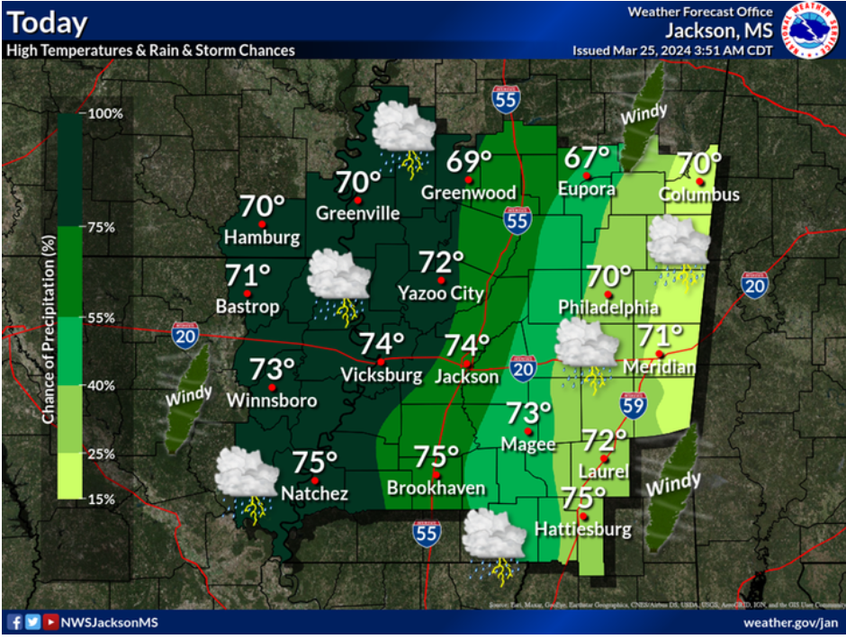
Today has been for the most part quiet and breezy, however rain and storms are starting to approach and move into the region surrounding Starkville, Mississippi quickly. The rain and storms are associated with a low pressure system that is approaching the area. This system will move through during the evening/night hours into the early morning hours tomorrow, bringing rain and storms with some being severe. Rain and storms will clear out by tomorrow afternoon, making way for sunny and clear conditions that will persist through the weekend and into next week.
A STORMY START TO THE WEEK TONIGHT INTO TOMORROW AFTERNOON
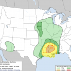
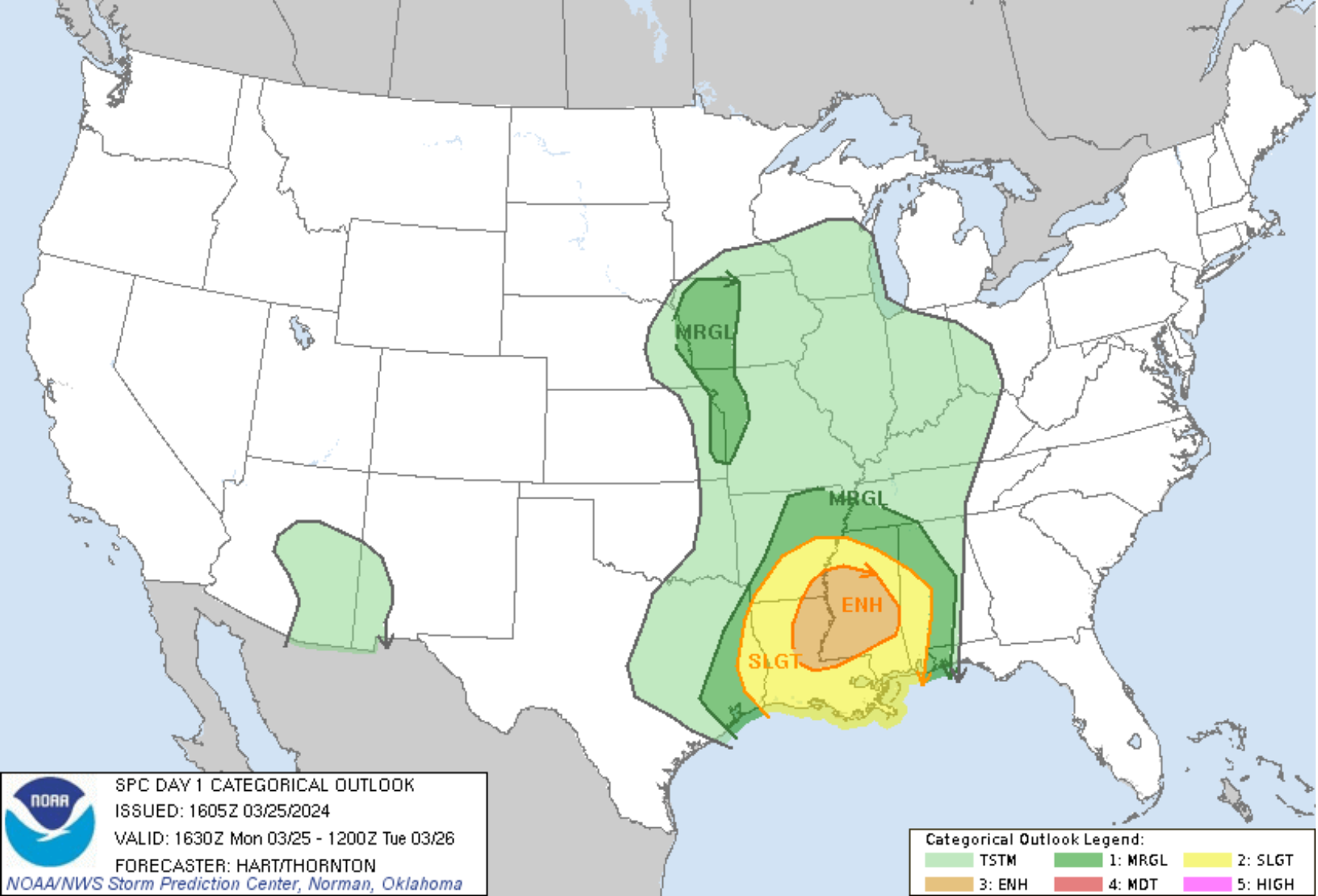
While temperatures have been sitting in the low to mid-60s throughout the day, gusty winds out of the southeast have helped to increase moisture ahead of the cold front that is expected to move through. As a result, a wind advisory is in effect. The characteristics of the environment are typical for a common early spring, as there is high shear and low CAPE (Convective Available Potential Energy) across the region. The main concern for Starkville, Mississippi with these storms is damaging winds, isolated tornadoes, sustained winds of 20+mph, and minor flooding. The main line of storms is expected to roll through between 9 PM and 1 AM, however rain before and after this line is likely. Flooding is only expected to occur in low lying areas and areas with poor drainage, and possibly near lakes and rivers around the area. Water levels in these bodies of water have receded since the last rainfall. It is suspected that the main severe impacts will stay just to the west of Starkville, with Starkville being on the fringe of the boundary between the enhanced and slight risk areas. Instead, the Severe Prediction Center elected to keep Starkville under a slight risk. However an isolated severe storm in or around Starkville cannot be ruled out. The main severe weather threat and the heaviest of the rain will end with the passage of the cold front making way for a temporary cool-off and dry weather throughout the area.
CLEAR CONDITIONS STARTING TUESDAY NIGHT AND PERSISTING THROUGH THIS WEEKEND
High pressure will begin to build behind the cold front that will move through, beginning an extended period of dry conditions to the area. Skies will be clear around the region over the next couple days, with high temperature sitting in the low to mid-60s, and low temperatures sitting in to mid-30s to low 40s through Thursday. The high pressure system will move eastward Thursday into Friday, and with that high temperatures will climb into the 70s, which is a trend that will not change through Sunday. Clouds are expected to return next Sunday and persist throughout the start of the wee. Temperatures are expected to reach into the high 70s to low 80s before rain rolls through next Tuesday, bringing temperatures back into the high 60s or low 70s.
Mitchell Keyes
Student Meteorologist