Feb 22, 2024
Tonight and Tomorrow:
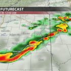
A quick-moving cold front will deliver scattered showers and the potential for a couple of strong storms late tonight into the early morning hours of Friday. The Storm Prediction Center (SPC) has placed north Mississippi underneath a (⅕) marginal risk for severe storms as a couple of storms have the potential to produce strong winds.
Once the front moves through northeast Mississippi, it will reinforce dry, sunny, and breezy conditions on Friday and into the weekend. Winds will shift from the north around 10 mph with gusts near 20 mph. Friday afternoon, high temperatures should climb into the mid-to-upper 60s.

Futurecast showing a couple of gusty storms possible late tonight into early Friday morning.
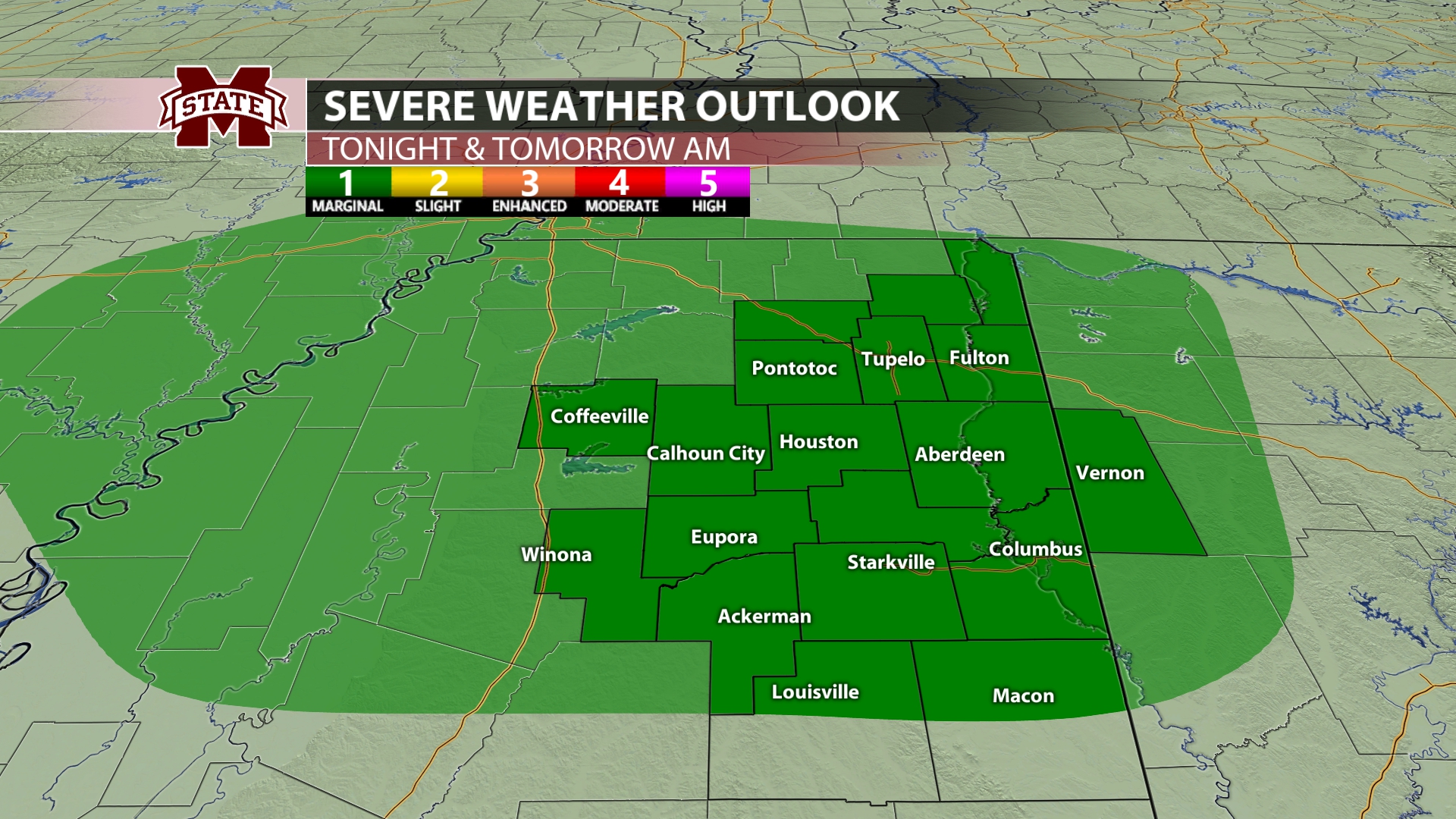
Storm Prediction Center (SPC) highlights north Mississippi under a marginal risk outlook for severe weather tonight into early Friday morning.
A Perfect Spring Weekend:
It will certainly feel like spring this weekend. High temperatures will reach the low- to mid-60s on Saturday and low 70s on Sunday. Sustained winds of 10 to 15 mph with gusts from 20 to 25 mph will persist throughout the weekend as the low-pressure system continues to track eastward. The dry, sunny, and breezy afternoon conditions will make for a perfect weekend to head to Dudy Noble Field to watch the Bulldogs take on Georgia Southern.

This weekend’s outlook.
Next Week:
A building ridge of high pressure will result in even warmer weather by early next week. Afternoon highs look to reach the mid-to-upper 70s on Monday and possibly near 80 for some areas on Tuesday. We remain dry and warm until our next cold front, which looks to arrive Wednesday into early Thursday, bringing the next chance for showers and T-storms. The SPC has already placed northeast Mississippi under a (⅖) slight risk for severe weather.
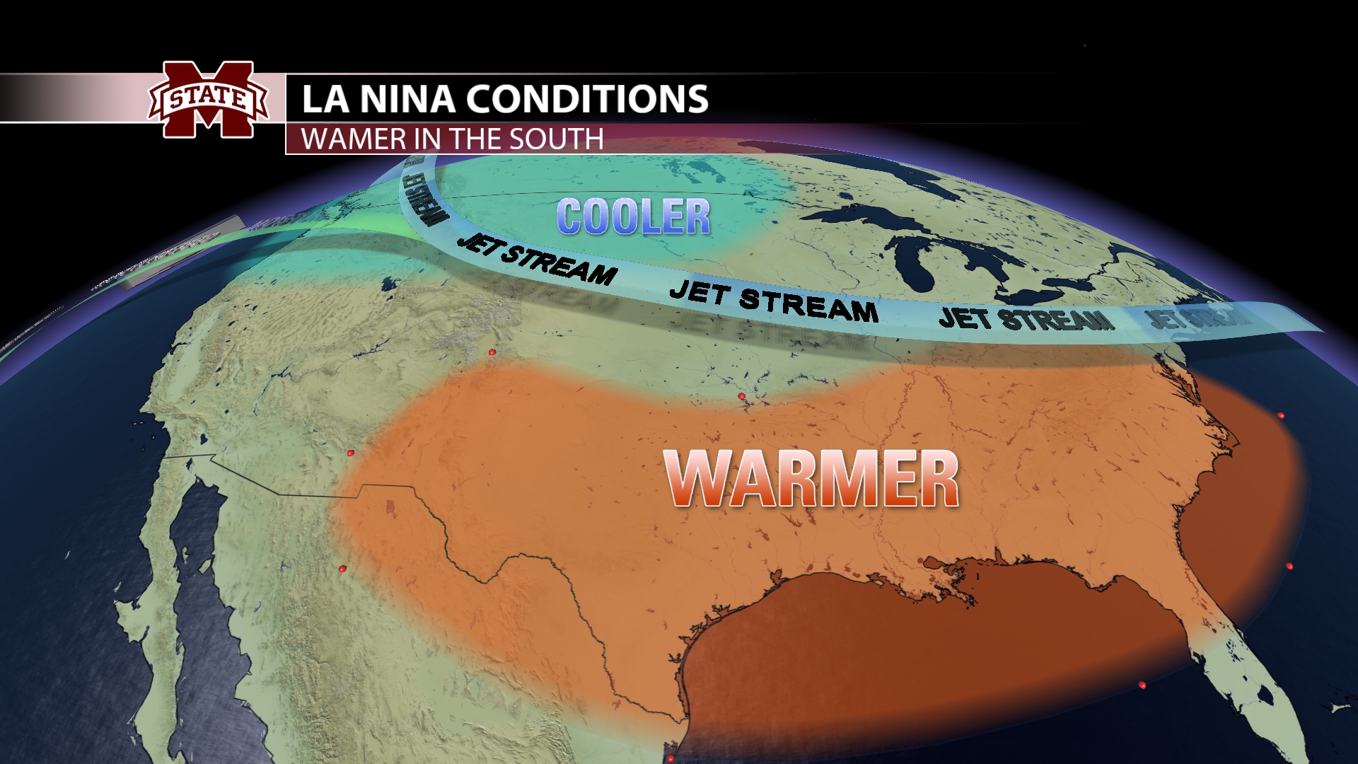
Climate Outlook: La Niña forecast to make a return
Not only do seasonal patterns drive our local weather, but so do global patterns. Just a few degrees difference in sea surface temperatures in the Pacific Ocean can change the climatological pattern, impacting the local weather in northeast Mississippi. In fact, we’ve experienced the influence of El Niño for almost a year, bringing a wet and chilly winter.
But, the collapse of El Niño is well underway. The National Oceanic and Atmospheric Administration (NOAA) has officially declared a La Niña Watch as odds suggest La Niña will develop in June-August 2024.
So, what does this mean for us in northeast Mississippi? Typically, La Niña brings conditions opposite to El Niño, meaning we expect dry and warmer conditions ahead. However, the more concerning impact of La Niña is the influence on hurricane season. The La Niña pattern allows for a much more conducive environment for tropical development, which could directly impact the Gulf Coast and increase the potential of northeast Mississippi being in the path of a storm. Hurricane season forecasts will start to come out over the next few months, and the first day of the season is June 1.
Student Meteorologist, Sydney Goldberg