Feb 26, 2024
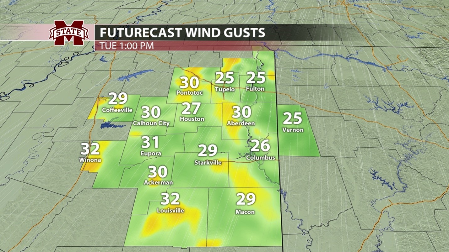
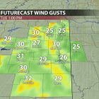
Wind gusts in northeast Mississippi could exceed 30 mph, particularly on Tuesday.
After a week of pleasant temperatures and dry conditions due to high pressure and upper-level ridging, change is coming to northeast Mississippi. A strong upper-level jet has resulted in the formation of an upper-level trough and low-pressure system followed by a strong cold front. This system is currently moving across western and midwestern portions of the United States. By Wednesday, it will make its way into northeast Mississippi bringing gusty winds, colder temperatures, and rainfall.
Tonight and Tomorrow:
Last week’s pattern of warm days, cool nights, and dry conditions will continue throughout this evening and Tuesday. Tonight, those low temperatures will be around 60, making for a comfortable evening. Winds could gust up to 25 mph, so it will be breezy. Cloud coverage will begin to increase late tonight and stick around through the rest of the workweek. Tuesday looks to be the warmest and most spring-like day that northeast Mississippi will have experienced this year with highs reaching near 80 and lows in the low 60s. Once again, strong wind gusts will be around, gusting up to 35 mph throughout the afternoon and evening. Other than being breezy, baseball conditions will be great for the Mississippi State game against Jackson State. Enjoy this weather on Tuesday while you can because Wednesday will start a period of more unsettled weather conditions and cooler temperatures.
Remainder of Workweek:
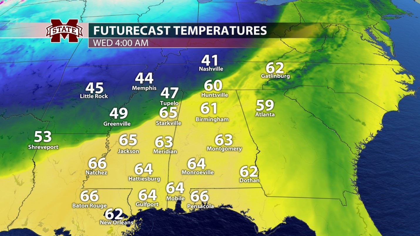
Wednesday will bring us our next major weathermaker. A low-pressure system will allow for the development of thunderstorms in Mississippi on Wednesday as it meets warm and moist air from the Gulf of Mexico. Currently, severe weather is not expected, but strong, gusty winds will continue to be an issue until the passage of the cold front. The main line of storms looks to arrive in northeast Mississippi in the early morning hours, with scattered showers sticking around throughout the rest of the day. As with Monday and Tuesday, wind gusts are expected to reach near 30 mph. Wednesday will be a warm day with temperatures peaking in the low 70s, but following the storm system’s exit will be low temperatures in the upper 30s for Wednesday night. Thursday will start breezy with wind gusts reaching near 20 mph, but calmer conditions will take over in the afternoon. While wind speeds on Thursday are expected to be lower, so are the temperatures. They are only expected to reach the mid-50s in the afternoon and drop to the low 40s overnight. Scattered showers are possible late Thursday evening and throughout the day on Friday. Friday will bring a similar temperature pattern, with highs reaching near 60 but dropping to near 50 overnight.
A strong cold front will be pushing through northeast Mississippi early Wednesday morning.
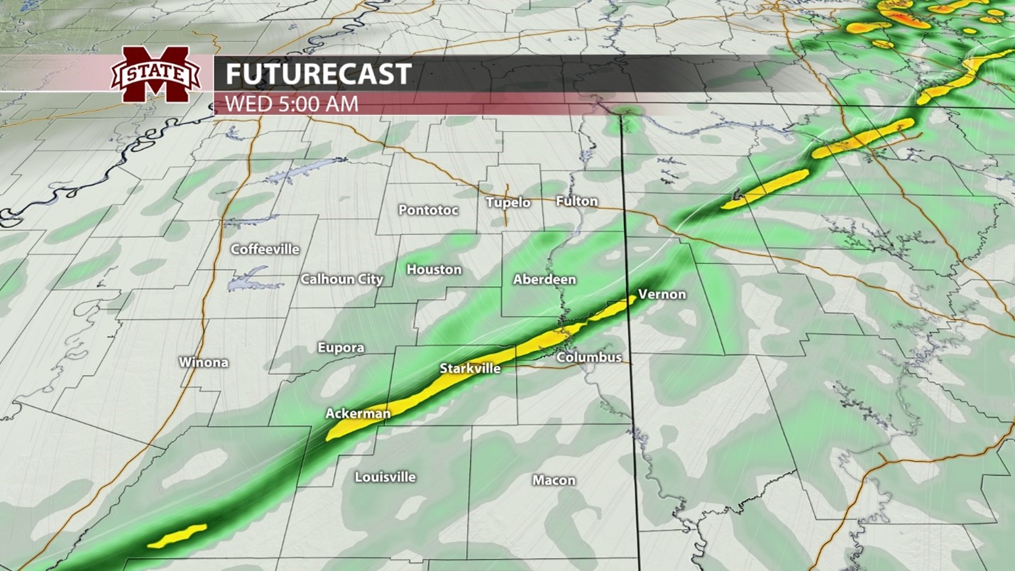
A line of showers and thunderstorms will impact the area early Wednesday morning.
Weekend/Early Next Week:
The weekend will bring warmer temperatures and dry conditions to northeast Mississippi, with highs on both days expected to reach near 70, with lows in the mid-50s. This warming trend is expected to continue into next week, with temperatures reaching the low 70s and dropping to the upper 40s. Models currently have a low-pressure system bringing rain to the area to begin the next workweek.
Student Meteorologist, Austin Powell